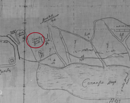
 Hubbard Map from the New York State Library |
 Map
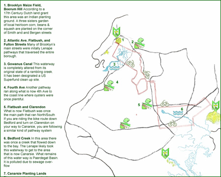
indicating route from Boerum Hill to Canarsie (work in progress) Map
indicating route from Boerum Hill to Canarsie (work in progress) |
||||
Maps
are a graphic reminder of how the city has changed and a resource for
imagining the city as it once was. To the left is a detail from the
1666 Hubbard Map from the New York State Library digital collections.
You can make out the words Canarsie Indian Fields, which correspond
to the area we are planting in. You can view an enlarged version of
this map online at: http://www.nysl.nysed.gov/scandocs/colonial.htm |
|||||